PlotWaterfall
PlotWaterfall[StackedData]⟹Plot
constructs a waterfall plot from StackedData, a collection of 2D coordinate pairs stacked in paired list form alongside their Z-coordinate values.
PlotWaterfall[DataObjects]⟹MultiObjPlot
constructs a waterfall plot from DataObjects, a list of references to data objects that each contain a list of 2D coordinate pairs.
PlotWaterfall[DataObject]⟹ObjPlot
constructs a waterfall plot from DataObject, a single data object reference that contains a paired list of 2D coordinates and their associated Z-coordinate values.
Details
Input

Output

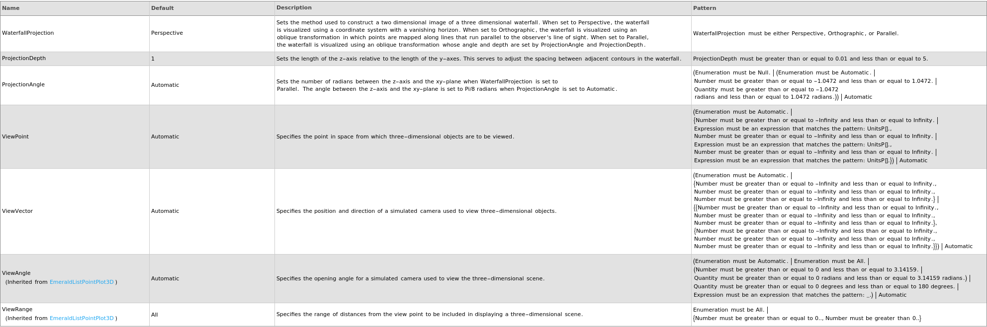
3D View Options
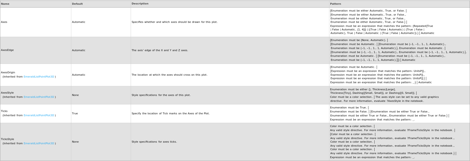
Axes Options
Box Options

Data Specifications Options
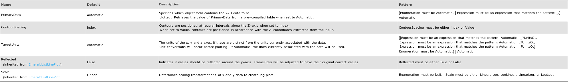
Image Format Options

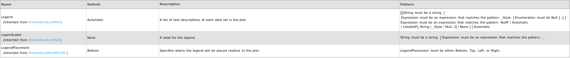
Legend Options
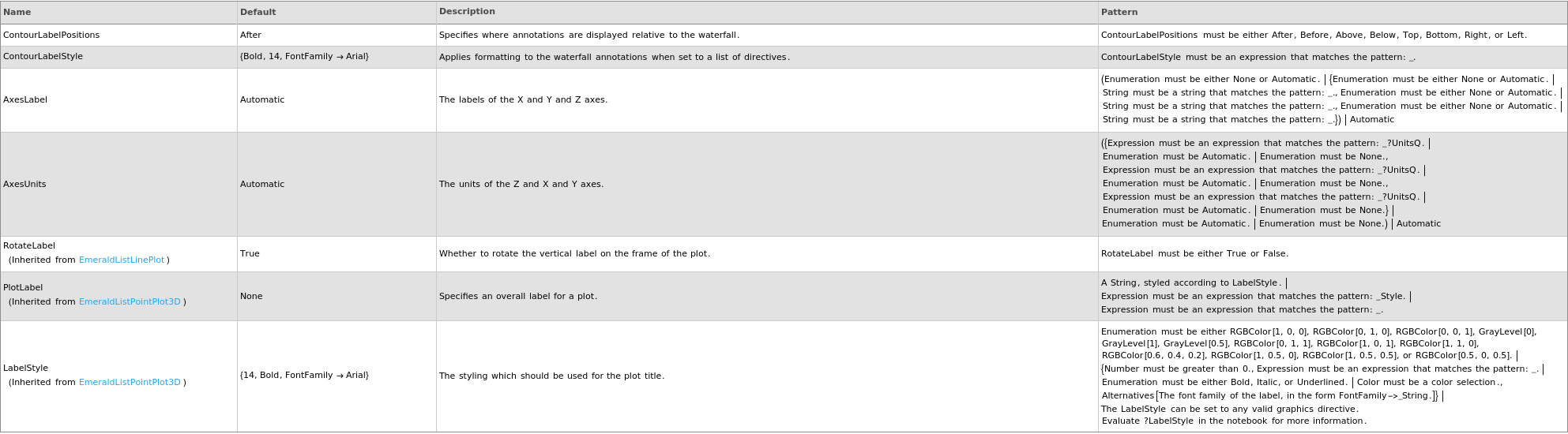
Plot Labeling Options
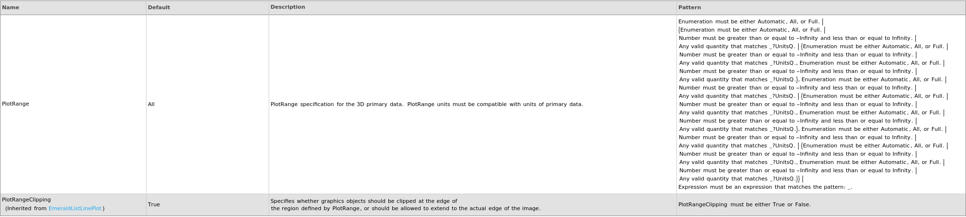
Plot Range Options
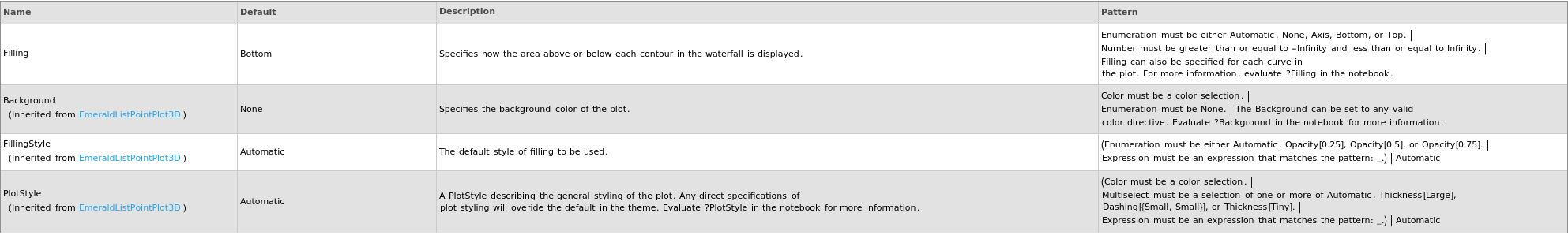
Plot Style Options
General Options

Examples
open allclose allBasic Examples (4)
Options (30)
Axes (2)
ContourLabelPositions (1)
ContourLabels (3)
ContourSpacing (2)
LabelField (2)

ProjectionAngle (1)
ViewPoint (3)
Messages (11)

LabelFieldLengthMismatch (1)


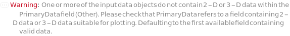
PrimaryDataInvalid (1)


Last modified on Tue 7 Oct 2025 18:43:10